
In May, 2018 work was completed on major improvements to Boca Raton’s El Rio Shared Use Pathway. This helps the City take advantage of the growth in commuter and recreation cycling that’s happening all across the United States. The U.S. Census Bureau reports that in a decade, bicycling to work has increased 60%. This is the largest percentage increase of all commuting modes tracked by the Census.
Connecting the two trails would provide a seamless cycling experience between the trails and also further add commuting options between cycling, Palm Tran and Tri-Rail.
Although the El Rio Trail is also awesome for other forms of recreation such as walking and running, this article focuses on bicycling on the Trail.
About the Trail
The trail starts at Glades Road and follows the El Rio Canal. It runs 4.8 miles North and ends at the Boca Raton border at the C-15 Canal and Congress Avenue. The Trail is shown in the red line with green mileage markers on the following map. The green marker identifies the Glades Road end and the red marker shows the Congress Road end.
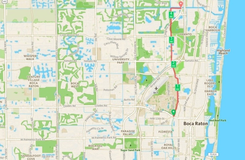
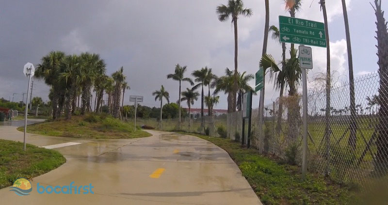
The recent improvements were made around Mile Marker Two and include Trail tunnels under Yamato Road and the FDOT railroad tracks. In addition, directional signage as shown below has been added to guide cyclists.
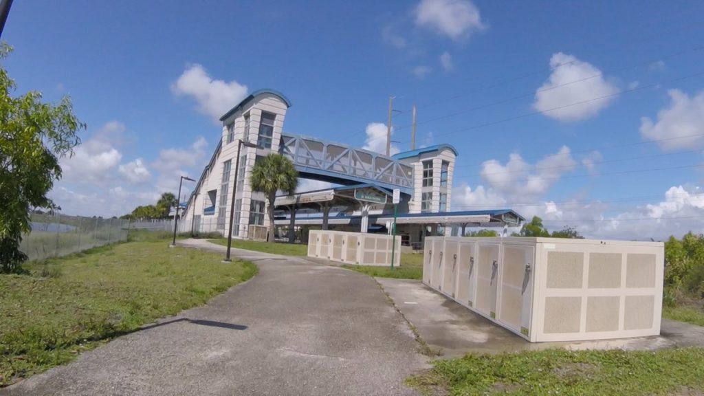
To further assist cyclists, a bicycle fix-it station and bicycle lockers are available at the Tri-Rail Station. A water fountain and rest areas that include benches are located at various points along the Trail. The video below shows riding various segments of the Trail, with the most footage devoted to the improved area around the Tri-Rail Station.
Some Cautions
One caution while riding the Trail is associated with cross streets. The Trail crosses the following streets:
- NW 20th Street
- NW Spanish River Boulevard
- Park of Commerce Boulevard
- Clint Moore Road
- Congress Avenue
The risk in crossing these streets is that the safety features available to cyclists are inconsistent at each intersection. Some of the intersections allow cyclists to activate lights that require vehicles to stop while others have no way to alert vehicles. In all cases, cyclists need to be aware and unassuming regarding vehicles seeing them and stopping.
Potential Improvements
A recommended enhancement, in addition to addressing the above street crossings, is to extend the Trail south to West Palmetto Park Road. As shown in the following map of shared-use pathways in Boca Raton, the path in black runs along West Palmetto Park Road from 441 in unincorporated Boca to NW 2nd Street in the City. This shared-use path is being improved with 8’ to 10’ paved widths along its entire 6.3-mile length. This project should be completed during the summer of 2019.
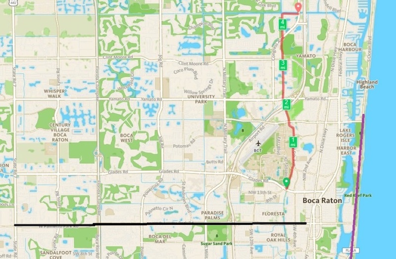
Connecting the two trails would provide a seamless cycling experience between the trails and also further add commuting options between cycling, Palm Tran and Tri-Rail. Another enhancement would extend the Palmetto Park Pathway to the A1A Trail, shown as a violet line on the above map.
We have provided information on the El Rio Trail with emphasis on the improvements recently completed in the area of the Yamato Tri-Rail Station. Check it out for yourself. You won’t be disappointed. With the improvements to the El Rio and the Palmetto Park Road Shared Use Pathways, Boca is positioning as a leader in a transportation infrastructure that minimizes dependency on vehicles. Advantages will include less traffic, reduced parking requirements, cleaner environment and healthier residents.